Posts

Lata Kijang Waterfall: A Step-by-Step Guide

Image
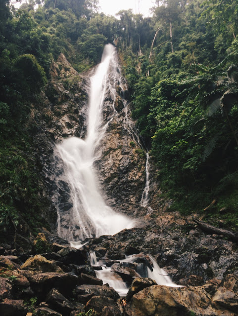
Lata Kijang Waterfall, Jelebu, Negeri Sembilan  Date visited: 21 January 2018 (Sunday) Vehicle: Preferably 4WD Duration of drive: 20 minutes drive from guardhouse to the waterfall. Possible to hike up from there. Getting There GPS: Lata Kijang Jelebu Negeri Sembilan on Google Map   ( https://goo.gl/maps/VB6T6BHdCLx ) Not to be confused with Lata Kinjang Waterfall in Perak, Lata Kijang Waterfall is located some distance off the Selangor-Negeri Sembilan border, and it is the tallest waterfall in Negeri Sembilan. This GPS location aims to direct you to the entrance of a forest reserve guardhouse, where you'll arrive at the waterfall in another 20 minutes drive.  Along the way here, you might come across many cyclists. The road will become narrower, but it is still well-maintained. Moving forward, you'll find yourself passing by a few kampungs before reaching.  We parked our cars in front of Balai Raya Kampung Tohor, hopped on our 4WD and continued on.

Setinggi Waterfall: A Step-by-Step Guide

Image
Setinggi Waterfall, Serendah, Selangor Date visited: 31 December 2017 (Sunday) Vehicle: Preferably 4WD Duration of hike: 1 hour with 4WD, about 2 hours if solely on foot Getting There GPS: Klinik Kesihatan Serendah on Google Map ( https://goo.gl/maps/zbh8VEn9UqH2 ) Once you turn in to the road that leads you to the clinic, go straight ahead. You’ll pass by a lake on your left, and reach a vague road fork. Slide left and follow the road on your left that doesn’t seem like a proper road. Follow the road, you’ll pass by the first factory on your left. The road will turn muddy and bumpy. If you do not have a 4WD, you can park your car at any open space available near the first factory because a part of the road ahead can be very muddy and impassable for normal cars. If you start your journey from the first factory, it would take you about 2 hours to reach the waterfall. For those with 4WD, drive straight ahead. You’ll reach a wide open space that’s awaiting furt